Saturday, December 18, 2010

Northbound

It's been a busy week in McMurdo trying to get prepared to leave Antarctica tomorrow. My team and I have been busily cleaning and returning gear to the Berg Field Center and the Crary Lab.

The biggest task this week has been preparing samples to be shipped north. I've got all kinds of samples that all have different processing and transportation requirements. It's kind of like trying to figure out how to load a grocery bag. You want your ice cream to stay frozen, your apples not to get bruised, and your eggs not to crack. Only here, I need my ice cores (from Garwood) to stay frozen, my soils (from Taylor) not to grow mold, and my rocks (from everywhere) not to get chipped. Fortunately, the cargo vessel that will be docking in McMurdo next month has freezers, coolers, and giant storage containers aboard that should get my samples home safe and sound.

Since Antarctica is in the southern hemisphere, and Portland is in the northern hemisphere, the ship has to cross the equator to get my samples home. It's pretty impressive to think that the ship can keep ice cores at -20*C (-4*F), even when it's 90*F outside. Since my soils don't need to be in a freezer the whole way back, they need to be dried so that they don't grow mold in the heat (the same way foods like potato chips or raisins are dried to keep them from getting moldy).

I'd say it has been a great season. We've learned a lot about how the "invisible streams" in Taylor Valley (the water tracks) come out of their winter freeze. In Garwood, we've begun to explore a frozen world that existed almost 10,000 years ago. It's been an adventure at times:

Sampling algal mats at the top of the Garwood Valley "ice cliff." It might not seem  like much of an adventure, but to get there I had to cut toe holds in the ice...
...all the way up to the top of the wall here. It's worth it, though, since we can carbon date the algae in the sediments. The sediments are on top of the ice, so the ice has to be at least as old as the sediments that bury it (geologists call this "the law of superposition). Get an age for the algae, and we've got an age for the ice. 
It's also been a great deal of fun. My colleagues--both the scientists, and the support personnel--have been a pleasure to work with. I'm definitely ready to be heading home, but a little piece of me is already excited about continuing to explore in Garwood valley next year!

Stay tuned to this blog during the "off season" for updates on what we've found in the Dry Valleys, news about publications, and more stereo pictures!

Northbound tomorrow.

Sunday, December 12, 2010

One last day in the field

I'm sitting in the Lake Hoare hut in the heart of Taylor Valley, waiting for a helicopter that will take me, Thomas Nylen (whose photos are in this post), and Jim O'Connor (a colleague from the US Geological Survey) down to the end of the valley for one last day of fieldwork. It definitely makes me sad to be leaving the field (and sadder to know that I have a solid week of labwork ahead of me--the same kinds of things I did earlier this season). But we couldn't ask for better weather, or a better last project.

We'll launch from Lake Hoare aboard an A-Star helicopter.

An A-Star helicopter dropping off a "sling load" (cargo attached to the helicopter by a cable).

A short flight down the valley, and we'll arrive at the New Harbor camp--a small hut and lab on the shore of the Ross Sea. I'm going to meet Ron Sletten, another permafrost geologist, to talk about a research borehole he's drilled into the soil here. Jim is going to look at more paleo-deltas from when the lakes of Taylor Valley were linked and flowed into the Ross Sea.

Then we'll walk inland to a spot called "Explorer's Cove." The LTER maintains a weather station there, where Thomas needs to do some maintenance work, and I need to collect one last soil sample. 

Then we'll continue our hike inland, past the Lake Fryxell camp, and then up and over the Canada glacier back to Lake Hoare. It should be a pretty excellent walk. Not a bad way to wrap up an Antarctic field season. 

Friday, December 10, 2010

Old Ice in Garwood Valley

I'm back from a week of tent camping in Garwood Valley--one of the southernmost Dry Valleys (more than 78 degrees South!). The mission was a great success. I'm starting a new project to study buried glaciers that flooded the valley more than 10,000 years ago. Unlike most glaciers from that era, which have long since melted, this ice is preserved under a thick sand cover.

Buried ice, to the right, in Garwood Valley. A 3 m tall weather station is next to the ice.

The ice is not stable, though. It formed under much colder conditions during the last glacial maximum and is now melting and sublimating away. It's particularly at risk of melting where the ice is exposed to the warm, dry summer atmosphere--so the "ice cliff" in the above photo is melting away like an ice cream cone on a hot afternoon. The melting of the buried ice, coupled with erosion by the Garwood river, means that this treasure trove of climate data from the recent past is quickly disintegrating.

A block of ice and sediment from the last glacial maximum that has tumbled from its perch into the Garwood river. Best not to be working on the cliff when one of these comes down.  

What we're trying to understand in Garwood is how thick was the ice in Antarctica 10,000 years ago and what was the climate like. This is important because Garwood is one of the few places in Antarctica that is currently undergoing rapid landscape change because of warm temperatures (relative to 10,000 years ago). It's like a crystal ball that we can use to look into the future of the Antarctic Dry Valleys to predict how the glaciers and permafrost soils will respond to a warmer world.

Wednesday, December 1, 2010

Off to Garwood Valley

Been a busy week back at McMurdo Station, getting camp in order for a weeklong trip to Garwood Valley. We're leaving the comforts of station life behind (dinner is running for over 1,000 scientists and support personnel in the galley, or dining hall, right now), and the structure of a well-organized field camp (like Lake Hoare) for a wild part of the Dry Valleys. We'll be putting in a small tent camp to explore buried ice deposits left over from the last glacial maximum. A toe of ice was left in Garwood Valley about 10,000 years ago. Locked in it is evidence of how Antarctica responded to sudden warming at the end of the ice age.

To give you an idea of what goes in to making a remote research camp work, I've attached the shopping list I took to the food issue room today. McMurdo has a little "supermarket" where you can stock up on supplies for the tent camp. All said, breakfast, lunch, and dinner for 4 people for 7 days came to 199 lbs. of food. It might not be the best chow on the continent, but there's sure a lot of it!


Friday Night--Burrito

2 lbs ground beef
1 bag cheese
1 box rice
salsa
1 bag fajita veg
1 bag tortillas
1 can refried beans

Saturday Night--Stirfry

4 can chicken
1 bag asian veg
soy sauce
chili
10 ramen

(double-up for weather?)

Sunday Night--Steak and Fish

4 x steak
4 x halibut
latkes: frozen hashbrowns bag
egg powder
italian seasoning
salt
pepper

Monday Night--Chili

2 lbs ground beef
2 cans kidney beans
chili powder
2 small green chili cans
1 can tomato garlic and onion
1 can tomato mexican
1 block tastee

Tuesday Night--Spaghetti

2 lbs pasta (not spaghetti!)
2 packages meatballs
1 can tomato sauce
1 can garlic and onion tomato
1 tomato powder packet

Wednesday Night--Thanksgiving

4 cans turkey
mashies mix
gravy mix
1 bag stuffing
10 oz.peas

(double-up for weather delay)

Thursday Night--Chicken Parm

12 breaded patties
1 bag mozzarella
2 packets tomato powder
2 lbs spaghetti

Friday Night--Steak and Fish

beef jerky
tastee cheddar cheese
cookies
cans of soup
olive oil
peanut butter
jelly
cabin bread
gorp
granola
milkman instant milk
bagels x 1 dozen
cocoa
raro (like Tang)
butter (1 box)
olive oil (small)
oatmeal x 1 box

Friday, November 26, 2010

Gobble, gobble.

Thanksgiving at the Lake Hoare Camp is a major event!

People from all over Taylor Valley hiked in to camp on Thursday to share Thanksgiving dinner with us, swelling our numbers from 6 to 30! We definitely needed the help to polish off the feast: a 28 lb. turkey, sweet potato casserole, stuffing, cornbread pudding, cranberry sauce and homemade chutney, gravy, pumpkin rolls, green peas, and 8 homemade pies.

I should add, we don't eat this well every day.

We've all heard of going "over the river and through the woods," but my heart goes out to the members of the snow patch project, who hiked over the Canada glacier to get here for dinner--and then hiked back the same night! (While the rest of us napped and digested).

It's not all feasting these days, though. I've been hard at work with Andrew Fountain, the chief of the project I'm working on, collecting soil samples in wet and dry portions of the permafrost. We're keeping these samples frozen once they're collected, so that colleagues of ours in Virginia can count the number of nematodes and microbes in the soil to see how the biological community responds to the underground streams I've been working on.

Tuesday, November 23, 2010

Well Met

Despite strong, gusty winds, we had a good day out at the weather stations (sometimes called "met" stations--short for "meteorology" stations). You might think that Thomas has a tough job, clinging to a 3 m tall mast, replacing sensors in the wind (and he sure does)...

Thomas Nylen at the Lake Vanda Met Station

...but my job's not only taking neat stereo images...

Thomas and Rae working on the Vanda Met Station, with "the Dais" cliffs in the background.

...It also involves making measurements of the Dry Valleys soils. Normally, it's nice to be low to the ground on a windy day. But with strong enough gusts, the sand on the valley floor begins to move and bounce--blown along by the gusts. This is called saltation, and is the process that piles up sand into dunes. On a really windy day, like last Thursday, the wind whips around any obstacle it in its way, making eddies of wind and sand, like eddies in a river. Any time I bent down to pick up one of my sensors, I became just such an obstacle. The wind would whip around me, and blast a column of sand right into my face. Not a fun way to collect a sediment sample!

Thursday, November 18, 2010

Antarctic Airborne

We're off by helicopter on a visit to the weather stations scattered around Wright Valley today!


The weather stations maintained by the LTER provide one of the longest records of climate information for the Dry Valleys of Antarctica. The first of the stations was installed in 1993, and they have been operating ever since. Each year, scientists from the LTER visit the stations to download the data recorded by the stations, and to make repairs (Antarctica is a harsh continent!). The weather data collected are the same kinds of things you'd expect to hear about on your local weather forecast: air temperature, relative humidity, precipitation (here, only snow), wind speed and direction, etc. The weather stations also record ground temperature, sunshine (how much solar energy is pouring into the ground surface), and "photosynthetically active radiation" (the part of the sun's energy that can be used by plants, like the algae and moss that live here). 

The stations are positioned all around the Dry Valleys, and provide a simultaneous measurement of climate conditions in this fragile ecosystem. The data have been critical for understanding how Antarctica is changing in a warming world

Today, I'll be helping with the station hardware, and then making ground surface temperature measurements near the stations to see how the permafrost at each site is faring. First stop: Lake Vida.

The Lake Vida weather station. 

Thursday, November 11, 2010

New Stereo Images

Flying from Lake Hoare to Lake Bonney over the Suess Glacier. 

Darting through "The Narrows" that divide the east lobe of Lake Bonney from the west lobe.

"Blood Falls" at the toe of the Taylor Glacier. 

In the Lab: Where Dirt Becomes Data

Back out at Lake Hoare camp, last weekend's whirlwind of lab activity seems like a distant memory. Working in the laboratory at McMurdo connects the fieldwork I've been doing with science--it's the place where we turn samples (say, bags of dirt) into data.

I'm working on understanding the relationships between soil water content, soil chemistry, and biological activity. So how does this happen?

The first step of the task is to find out how much water is in the soil at different times of the year. I can do this by baking the dirt at 105*C (~221*F) to evaporate all the water out (or, in the case of the permafrost, to thaw all the ice in the soil, and then evaporate out the water). By weighing the soil before I bake it, and after I bake it, I can measure the mass of water in the soil. Basically, the process is like making a mud pie.

Once the soil is dry, there's all kinds of things you can do with it. I usually take a picture of the sample, so I can remember what it looked like (was it powdery, or sandy? clayey or rocky). It's important to document everything, since I processed 71 different soils this past weekend.

A sandy, silty soil with a few pebbles.

The next step is to split the sample, taking a small baggie of the soil to bring back to Oregon for further analysis. We can run some tests on the soil here, but not everything we'd like to do. I also take a small amount of soil to burn. Everyone's heard of a mud pie, but charbroiled dirt is a little unusual! By cooking the sample in a furnace at a high temperature, I can burn off any organic matter in the soil (microbes, algae, etc.). We need to do this to get a measurement of how big the biological community in the soil is. 

Then it's time to soak the soil again. I know what you're thinking--didn't you just dry the soil? Once the soil is dried out, it's time to look at the chemistry of the dirt. I'm most interested in what happens to the soil when summertime snowmelt and ground ice melt dampens the soil. To simulate this, I precisely weigh out water to mix with the dirt. The water is super-clean water that has been filtered to remove nearly every chemical impurity. When salts dissolve in water, they form ions-- for example, table salt, sodium chloride, dissolves to form a positively-charged sodium  ion, and a negatively charged chloride ion. This super-clean water is called "deionized water." 

Weighing out water and soil. Two parts water to one part soil should do the trick!

By adding my imaginary snowmelt to the soil (mixing deionized water with the soil), I can dissolve all the salts that were present in the soil when I collected it. Some of the salts were carried to the soil by the wind all the way from the ocean (lots of the sodium and chloride), while others were actually leeched out of the sand and pebbles that make up the soil by the meltwater (much of the magnesium and iron). Salts matter here because they help generate meltwater (the same way salting the roads when it snows raises the melting temperature of ice, allowing it to melt away faster). I shake the bag to mix it all up, and then let it settle for a little while so that the sediments (all the sand, silt, pebbles, etc.) can settle to the bottom of the sample bag.

 Joe's artificial mud: special recipe.

Some of the murkiness of that mud comes from the fact that it's not just sand and salt and water in the bag, but also organic compounds. Nutrients of all kinds are found in the soils of Taylor Valley, and help sustain the organisms that live here. Just like gardeners back home, we're really interested in how much phosphorus and nitrogen is in our soil. 

Now that I've made something of a mess, it's time to clean things up. Our analytical machines can't make sense of thick, gooey mud, so I need to filter the water. We use filters that are so fine that no sand fragments can pass through, but that have big enough holes to allow the various salts to pass to the other side (the holes are 0.45 microns across, or about 1/2,000,000th of a meter wide). 

Filtering mud. The doodad with dials is a vacuum pump that sucks the air out of the jar to the right. The sample sits in a little funnel attached to the top of the jar, separated by the filter, and gets pulled through the filter by the vacuum on the other side. It's like a super-powered coffee filter, separating the soils (here, soil) from the liquid.

Sometimes, the soil is sandy and rocky, and doesn't make a thick mud. Those samples filter very quickly. Other samples are thick and gooey, and can take a long time to filter, even with the vacuum pump going full tilt. 

Looks like it's going to be a long day of filtering....

Once all the bottles are filled with salt water from the soil, they'll get analyzed by our chemist, Kathy Welch. What we'll learn from the samples is how much salt, of several different varieties is in the soil here. Understanding how salt has been sprinkled over the landscape is one of the keys for figuring out who lives where, and where the water will flow. 

Saturday, November 6, 2010

The Big Picture

Sunday is lab tour day here in McMurdo. Folks from all over the station come in to the Crary lab to find out what the scientists are up to. As I was telling folks here about what it is that I do, I realized that I haven't really given a big picture explanation of what my research is all about. Most folks know that I disappear to Antarctica once a year or so--here's why!

As I mentioned earlier, I'm working with a project called the McMurdo Dry Valleys Long Term Ecological Research project (MCM-LTER). The LTER is actually part of a much larger network of scientists who are trying to understand how climate change affects ecosystems. You hear the word "ecosystem" a lot, but all it means is the relationships between living things (like trees or fish) and their physical habitat (soil, air, water, etc.) .LTER wants to know how those relationships are changing in a changing world.

The McMurdo LTER has it easy. We study one of the simplest ecosystems on the planet, the Dry Valleys I've been writing about. In Taylor Valley, sunlight, water, and soil are used by microbes and algae and moss to make food and energy (they're called "primary producers" and are the core of the food web). Some microbes eat algae or other microbes, which are all food for some tiny, microscopic invertebrates (things like rotifers and tardigrades) I think tardigrades look pretty alien:


The top predator in the Taylor Valley ecosystem is the fearsome nematode . This microscopic worm is only about 1 mm long (so about 100 of them could party on your pinky nail). And that's just about it.

So why is it important to understand the relationships between these simple living things and their environment, and how it is changing as the Antarctic climate changes? Because, like it or not, we live in an ecosystem of our own (they say up in Alaska, "Step out of the car, and into the food chain"). More broadly, we depend on clean air, soil, and water to grow crops. We depend on microbes in the soil to make it fertile, and on bees and other bugs to pollinate our plants. We depend on rivers and lakes for water, and on the very complex ecosystem of the ocean for food--and more importantly, for algae and plankton, that make most of the oxygen we breath every day through photosynthesis.

Learning about how a simple ecosystem is changing gives us a model for how more complicated ecosystems change as the air and soil warm. What will happen in Taylor Valley over the next few years to decades? Will the microbes that pry minerals from the soil suffer from warming dirt, cutting off the base of the food supply? Will the nematodes, feeling fast and feisty in the warm temperatures over-hunt and exhaust their food supply? Will the glaciers that ring the valley melt, flooding out organisms that cannot find dry habitats fast enough? These are the kinds of questions that the LTER is trying to answer (and many others, of course!). The answers to these questions will help us predict how the ecosystem that we inhabit will change as the physical world changes around us.

Time to head back to lab work. I'll be heading back out to the field tomorrow if the weather holds, and will write about what I've been up to on station.  

Thursday, November 4, 2010

Back in Town

I'm back at McMurdo Station this weekend to process the samples I've been collecting over the past three weeks!


McMurdo Station is the main US base in Antarctica and is home (as of yesterday) to 1143 scientists and support staff (I guess I make it 1144 in total). The base is perched on the rocky shores of Ross Island, about a 45 minute helicopter flight from Lake Hoare in Taylor Valley.

In the above photo, you can see the big fuel tanks (to the right) that keep the lights on and the buildings warm. In the middle of the picture is the cargo yard, where several years of supplies are kept (in case weather turns bad, planes can't fly, and the resupply ship can't break through the ice). Over on the left side of the image is a gray building that's in three pieces connected by ramps. That's the Crary laboratory, which is the scientific heart of the station. It's where I'm writing from right now!

The bright white expanse to the far left is the frozen surface of the Ross Sea. All in all, it's a very tidy station, but after a few weeks out hiking and sampling, it seems like the big city!

In my next post, we'll take a closer look at what I'm doing in the lab, and just what it means to be washing dirt.

Saturday, October 30, 2010

Warm(er) Dirt

Just a quick update, since the data link has been a little bit fussy the past few days. 

As I mentioned in my last post, part of my project is to better understand how heat moves in and out of the soils of Taylor Valley. Yesterday, I was taking the dirt's temperature with an infrared thermometer. This instrument reads the temperature of an object by measuring the frequency, or color, of the infrared radiation coming off of it (sort of like a red-hot stove burner, or the blue-hot core of a candle flame). Most of the soil surface is floating around -5*C to -10*C (still very hard frozen). 

As it turns out, few rocks have warmed right up to freezing (0*C), and even gotten warmer (2-3*C). This is because the rocks are low albedo (like in the This Orange Earth post). They absorb a lot of solar radiation, so they warm up rapidly in the sunshine. 

After lugging a 40 pound pack up the valley wall, measuring temperatures as I went, I was able to find a warm (3*C) rock yesterday afternoon that was big enough to lay down on for a quick nap after lunch. There's nothing better than a fifteen minute field nap on a sunny day in Antarctica. 

Tuesday, October 26, 2010

Dirt.

Today, it's finally time to talk a little bit about dirt. I've been tramping back and forth over the soils of Taylor Valley this past week, collecting permafrost samples (remember, permafrost is just a land surface that's been below 0*C/32*F on average for more than two years running). I just downloaded the temperature record for the last year from a sensor bundle that we left out over the winter (when it was just too cold and dark to be here). As you can see from the graph below, this is a serious permafrost environment (for the record, the average annual temperature here is about -18*C/0*F--right now, most of the soils are around -20-30*C, which makes for some cold walking!)


So what are these soils, and why am I so interested in them? Basically, the soils of the Dry Valleys are sands. Antarctica is a cold desert, so sand kind of makes sense, right? Actually, the reason that it makes sense--not all deserts are sandy--is because very little lives in the soil here. Microorganisms, plants, animals and fungi all break down rocks and minerals (and other organisms) at warmer latitudes, to produce a complicated, carbon-rich soil. Here, because of the cold, and because of the dryness, very little biological work occurs. As a result, the soil is mostly made up of sand blown in by the wind or carried in by old glaciers, ancient lake and ocean sediments that have been sitting around for thousands of years, and rocks and boulders that have fallen down the steep valley walls. As a result, the soils look a lot like this (that's a ~2 cm diameter rod in the middle of the picture):


You might think that looks really rocky, and there's a reason for that. If you were to take a shovel-full of Taylor Valley dirt, you'd find that it's about 70% (or more) sand (geologists have a very precise definition for sand: rock fragments smaller than 2 mm across. But generally, you know sand when you see it). So where's all the sand in that picture? The winds here are persistent (you may notice I talk about the wind a lot). The wind blows the fine grained sand away, leaving behind a lag of rocky debris at the surface. Anywhere there is sand to blow away, the wind takes it, leaving an interlocking group of pebbles and cobbles that looks like a jigsaw puzzle or a mosaic. This material is called "desert pavement."

The other kind of "pavement" that I'm interested in here is called "ice cement." Even though the soil at the surface is very dry, if you dig down a little bit, you quickly find that ice has filled the pore spaces between sand grains. The ice has condensed there because the ground is so cold (the same way condensation forms on  a glass containing a cold drink--the glass is much colder than the air, so water vapor gets "cold trapped" and condenses from water vapor to liquid water--or in the case here, as ice). The ice fills up the spaces between sand grains (the pores), the same way water fills up the pores in a sponge.

This ice-dirt mixture is extremely hard (that's why we call it ice cement). When I talk about "sampling" ice cement, it means whacking it with a pick ax to dislodge fragments that I can dry (to measure how much ice was in them when they were frozen) and then re-wet to dissolve all the salts and other nutrients in the soil, which my colleagues will then analyze later this season.

The permafrost is hard-frozen now, but when it melts later in the summer (you can see on the graph at the top of this page that sometimes the ground is well above freezing), it will become soggy and soft--the perfect environment for algae, microbes, and even tiny worms called nematodes. These critters form the southernmost biological community on Earth, and are the focus of LTER research. My job here is to understand the permafrost that is these organisms' home. We're trying to understand how water moves in and out of the soil, and how heat moves in and out of the soil, over the course of years, decades, and even centuries. Here at the extremes of the Earth, heat plus water plus light equals life. Right now, we've got the light, and plenty of water. The soil is just waiting for heat from the sun to work its ecosystem magic.

Thursday, October 21, 2010

Down in the valley....valley so low....do some geology....hear the wind blow....

It's been a windy few days here in Taylor Valley, but that's a good thing!

Most people associate wind and cold with "wind chill." This is the perception that weather feels colder on a windy day. Wind chill cools you down because it replaces the warm air right around your body or clothes with cold air (wearing windproof clothing like we do here helps reduce the feeling of wind chill greatly).

Interestingly, wind chill was first studied scientifically by Paul Siple. Siple was a Boy Scout on one of Admiral Byrd's Antarctic expeditions, and went on to become a major figure in Antarctic history. (It's part of his legacy that a Boy Scout and a Girl Scout are annually rotated through the Antarctic bases--you never know who will have the next big idea!).

So why is wind a good thing here? Oddly enough, it depends on which way the wind is blowing. When the wind blows down-valley, it means that the air mass is coming off the polar plateau (where the ice cap is). This air is very cold and very dry. As it descends into the valley from high on the plateau, the wind suddenly finds that it's at a higher pressure than it was before (in the same way that air pressure is low on a mountain top, and high at the base of a mountain--there's more more atmosphere above you at the base of the mountain, squeezing down on the air around you, resulting in a higher air pressure).

This squeezing of the wind (an increase in pressure) raises its temperature. This is the ideal gas law at work in nature (it's also the same phenomenon that you observe when you pump up a bike tire or a basketball--by raising the pressure inside, the air in the tire or ball warms up, too).

So, since I got here, the temperature has been hovering around -25*C (-13*F) (did I mention that it's spring time here?). Once the wind started blowing yesterday, the temperature raced up to -10*C (14*F), and even pushed -5*C (23*F) for a couple of hours. Down right balmy.

Nice weather means that it's time to be outside working, though. More about the permafrost soon!

Wednesday, October 20, 2010

Antarctica in 3D!

Here's a first round of stereo images from Taylor Valley. The camera that I'm using has two lenses that are spaced about eye-ball distance apart. As a result, if you look at these images full screen, and gently cross your eyes, you'll see the two images begin to converge into a third image. When the the two pairs are lined up, relax your eyes a little, and you'll see the image in 3D! I'll process the whole batch of stereo images I've taken when I get back to Portland, and will post easier-to-see red/blue 3D images and stereo pairs for folks with fancy 3D TVs.


An island in the middle of Lake Hoare. Canada Glacier in the background. The lake ice cover has smooth, more melted areas, and rough areas that are in the process of melting. 

This is one of the LTER weather stations. There's an anemometer (wind guage), snow collector (the big trumpet-shaped thing in the background), sunlight sensors, and more.


Robert Falcon Scott--the famed explorer. Not getting the respect he deserves in Christchurch.

My tent at the Lake Hoare camp. The lake is in the background, and some of my permafrost sample sites are in the background across the lake. 

More images to come!  


Monday, October 18, 2010

Hailing frequencies open (from the field!)

Hello from Lake Hoare! This blog post comes to you live from the McMurdo Dry Valleys--Taylor Valley in particular. Camp is a gathering of huts (labs, cooking and eating spaces, generator, storage) and tents (for sleeping), situated at the toe of the Canada Glacier. Upvalley (to the west, away from the shores of the McMurdo Sound and the Ross Sea) is the Suess Glacier. In between these two giant ice conveyor-belts sits Lake Hoare, one of the famous ice-covered lakes of the McMurdo Dry Valleys.


We're celebrating the hundredth anniversary of the exploration of Taylor Valley this year, and explorers and scientists have been visiting the valleys regularly since (with particular interest in the Dry Valleys begining in the late 1950s). In one sense, the McMurdo Dry Valleys are very well understood. The valleys are "dry" because they are not covered by the Antarctic ice-cap (more than 99% of Antarctica is buried by the ice cap)--the glacier-like cap is held back from the Valleys by the tall Transantarctic Mountains that hem this side of the Ross Sea. The Dry Valleys aren't "dry," though.

As you can see in the picture, alpine glaciers (like the Canada) flow down the valley walls and spread across the valley floor. During summer months (December to February), the snouts and surfaces of these glaciers melt, generating streams that flow into low points between the glaciers, forming ponds and lakes. Because the average annual temperature in Talor Valley is -18*C (about 0*F), with summer air temperatures seldom rising above ~10*C (40*F), these ponds and lakes are perpetually covered by thick, floating ice covers. The Dry Valleys are "dry," though, in that they recieve very little precipitation: 3-50 mm of "water equivalent" snow per year ("water equivalent" means that you imagine melting that snow once it fell on the ground to form a height of water--just like when the weather report says that a storm dropped 1/2" of rain. Snow is puffy and low density, so it's difficult to describe how much fell unless you make this conversion.) One or two recorded rainfall events have occured in the whole history of the Dry Valleys (down at the coast), while some higher, inland areas have not seen substantial liquid water in millions of years.

What's missing from this short accounting of the history, geography, and climate of the Dry Valleys is permafrost (and biology--more about that later). Everything that you see in that photo that is not a glacier, lake, snow, or human structure is permafrost. Permafrost is nothing more than a ground surface that has remained below freezing, on average, for more than two years. Perennially frozen soil is my specialty, and is the reason that I've come all the way to Antarctica. Permafrost is the "dirt" in "Cold Dirt," and I'll be talking more

Thursday, October 14, 2010

Off the Grid, Onto the Map

After a whirlwind week of packing gear, testing scientific instruments, and attending briefings, here in McMurdo Station, I'm off to the Dry Valleys tomorrow (Taylor Valley in particular, on the above map)! The good news: I'm on my way. The bad news: the Communications folks on station haven't gotten the internet up and running yet, so it may be a while until my next post. I'll keep a log, though, and update in bulk when we get connected.

I'm headed to the Lake Hoare fixed camp (located near the "a" in Valley on the map), along with 700 pounds of cargo, clothing, instruments, and sample bottles. Exactly why I'm headed to this out of the way place is the subject of the next post.

Monday, October 11, 2010

This Orange Earth (or, Why It's So Cold)

Southbound. Bags are packed, parkas and boots are on, and I'm loaded aboard a US Air National Guard C17 cargo plane with 38 friends, colleagues, and support staff, winging our way wouth towards Antarctica.

This blog is called "Cold Dirt," and as you'll see, it's all about the cold, frozen, icy, and in places, rapidly thawing soils found in the McMurdo Dry Valleys of Antarctica. Before I dive in to the science of permafrost geology, and glaciology, and all the other research subjects that are the focus of this expedition, I thought it might be worthwhile to unpack these two ideas--"cold" and "Dirt."

Everyone likes to complain about the cold (even Antarctic explorers!), but most folks don't stop to think about why the Earth's poles are as cold as they are. We've become used to seeing pictures from space, or even just plotted on a globe, showing ice caps at the north and south ends of our planet. Why is that?

Almost all of the heat that we feel at the Earth's surface comes from the sun (a little bit trickles up from the warm interior of the Earth, but not enough to feel in most places). The sun beams light towards the Earth, which travels though space, and ultimately arrives at the top of our atmosphere. If you put a solar panel right at the top of the atmosphere to collect that energy, you'd find that every sqaure meter (imagine a solar panel one meter, or about 3 feet, on a side) would pick up about 1250 Joules of energy every second. A Joule is a fiddly unit of energy (your electric bill doesn't count Joules, and for good reason), so it helps to think in Watts (a Watt is one Joule of energy being collected or used every second). A Watt is a measure of power (so a 300 Watt hair drier is more powerful than a 400 Watt hair drier, because every second that it's on, it can turn 100 more Joules of electrical energy into heat for your hair than the 300 Watt drier). Back to the top of the atmosphere, some of that sunlight (solar energy) gets reflected back into space (goobye sunshine!) and some of it shines right down through the atmosphere to the surface. Once it finally reaches the ground, some of that sunlight gets absorbed, warming up the land, ocean, trees, people--everything at the Earth's surface (this is why sunlight feels warm on your skin--you're absorbing energy in the form of solar radiation, and converting it into energy in the form of heat).

That's how the Earth gets warmed: solar energy, in the form of radiation gets absorbed and turned into heat. But why are the poles cold? To understand this, it might  make sense to come down from the top of the atmosphere, and to head into the kitchen or to a  grocery store. Find yourself a nice round orange with a label sticker on it (they usually say, "Florida," or "Sunkist," or even "Apple" if you've got a sarcastic grocer). The orange represents the Earth. The stem-spot on the orange represents the South Pole. For the sake of simplicity, now pick up the orange and hold it out at arm's length, with the south pole pointed down at the floor (if there'a fruitfly buzzing around the orange, somewhere near it's lower half, that represents me, sitting here on this plane). By holding the orange out at arm's length, now you represent the Sun. If you spun around in a circle by pivoting on your toes, you'd be simulating the Earth revolving around the Sun. You'd also look kind of silly.

Now, about that label sticker. On your Orange Earth, the sticker represents a blanket, spread out for a picnic (yes, people picnic in Antarctica, but that's for another post). Hold the orange with your thumb on the south pole, and another finger on the north pole (the opposite side of the orange). Now peel off the sticker, and put it on the side of the orange, right in a spot that's half way around the orange between the north orange pole and the south orange pole. Now the sticker is on the orange's equator. Hold the orange back at arm's length, with the south pole pointed at the floor, and take a look at the sticker. If the sticker is pointed right at you (remember, you're the sun), you can see the whole sticker. All the energy coming out of you (the sun) can be absorbed by that big picnic blanket, rapidly warming it up under the noon sun (if you've every picniced near the equator, you know it can get pretty hot, pretty fast in the direct sunlight). Now peel off the sticker, and put it down near the stem of the orange (the south pole). Now the picnic blanket is in Antarctica. If you hold the orange back out at arm's length, with the south pole (stem) pointed at the floor, what do you see? You can't see the whole face of the sticker! The curvature of the Earth points the sticker away from your eyes (the sun), so that you can only see a little bit of it. Now, the picnic blanket can only absorb sunlight from you, then sun, if the sun's rays (solar radition) can travel from then sun to the ground. Since you can only see a small portion of the sticker, it means that only a small portion of the sticker gets direct sunlight, that can be absorbed, causing the blanket to warm up. The picnic blanket (sticker) near the pole gets less direct sunlight, over a smaller surface area (the part of the sticker you can see), than the picnic blanket at the equaotr. It's going to be a cold lunch in Antarcitca!

The fact that the poles absorb less solar radiation than the equator is only part of the reason that the poles are so cold. The other piece of the puzzle comes from how the two picnic blankets lose heat. Just about everything in the universe loses heat by emiting infrared radiation. Infrared radiation is the kind of radiation that you feel when you stand in front of a fireplace or radiator (makes sense why they call it that). The ground loses heat at night by radiating infrared energy off into space (this is on reason why clear winter nights are so cold). Both picnic blankets lose heat at about the same rate, radiating infrared radiation from their surfaces back out into space. The blankets have a "heat budget" and get hotter when they absorb more solar radiation that they lose through infrared radiation, and getting cooler when they lose more heat than they absorb (the same way a bank account--a personal budget--grows bigger when you spend less money than you earn, and gets smaller when you earn less money than you spend). The polar picnic blanket takes in very little heat from the sun, but loses plenty to space, while the equatorial picnic blanket gets plenty of sunlight, and only loses about as much energy as the polar blanket, helping keep it heat-rich and warm.

The last wrinkle to why the poles are so cold can be figured out by holding your orange Earth out at arm's length and taking a picture of the orange with a camera that has a flash. What do you notice when you look at the picture of the orange? Most of the orange looks about the same in the picture, but the sticker on the orange should look super-bright in the light from the flash. The reason the sticker looks so much brighter than the rest of the orange is because the sticker reflects more of the light from the flash than the orange does (this is becuase the sticker is shiny and light-colored). The fraction of the light that a surface reflects is called its "albedo" (something like concrete that reflects half of the light that gets shined on it has an albedo of 1/2, while something that reflects all the light that's shined on it, like a perfect mirror, has an albedo of 1). Fresh snow has a very high albedo (more than 9/10, or almost 1). Reflected sunlight never gets absorbed by the ground, meaning it never gets to be part of the ground's energy budget, and can't warm it up. All of the snow and ice at the Earth's poles means that they have a high albedo. The poles reflect a lot of their tiny share of sunlight back into space, so that it never gets a chance to help warm the ground.  

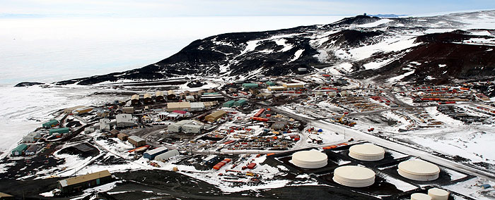
So that's the "cold" part of "Cold Dirt." I'll talk more about the "Dirt" once I reach my science site. For now, though, I've got a few more hours of flying time, before we land on the ice runway at McMurdo Station (edit: made it in on the second pass! Hello from McMurdo!). Time for a quick nap in the parka, and dreams of fresh oranges.

Thursday, October 7, 2010

Getting there (from here)

If you're not a penguin (they swim), airplane is the best way to reach Antarctica. Antarctica is the southern continent, so from anywhere in the USA, you could just go south, and you would eventually reach the Antarctic. But Antarctica is a big place, so just "getting there" doesn't necessarily mean that you've gotten where you need to go.

I'm working in the McMurdo Dry Valleys (77S 162E). If you pull out a globe (okay, or Google Earth--it has some great satellite images) you'll seem that this is nearly due south of New Zealand. If I flew south from Providence, RI, my old home, I'd arrive on the wrong "side" of Antarctica (technically, the wrong coast). The Antarctic Penninsula is fascinating in its own right, but with a land area about the size of the US and Mexico put together, there'd be a lot of Antarctica between me and the Dry Valleys.

So I'm off to Aukland, New Zealand tonight. From there, it's on to Christchurch on the south island. More from NZ (and from "tomorrow"-- I'm about to gain 16 hours of time zone!)

Tuesday, October 5, 2010

Into the Blizzard (Again)

I'm too far down valley and that snow is closing in fast. At my feet are rocks, boulders, and sand--shattered bowling balls and ball-bearings of brown and red dolerite. I'm digging a soil pit, and when the hole is knee-deep, I hit pay-dirt. Ice, actually. Three million year old glacier ice, some of the oldest ice on Earth, that's been moving as a debris-covered glacier, inching its way down valley (the absolute oldest ice is even further down the valley). I've had my eyes on the ground all afternoon, and now the clouds that were skirting the mouth Beacon Valley have marched their way up towards me. The air is filled with with swirling snow, glinting in the failing sun like harsh confetti. The temperature is dropping fast as the warm rays of the sun are swallowed up by the growing storm. I've got thirty pounds of sand and ice in my pack, and three kilometers to make it back to camp before the weather turns to whiteout. It's going to be an interesting hike...

That was December of 2004. It was my first season in the Antarctic as a scientist studying permafrost (frozen ground) as part of a project to understand frozen landscapes on Mars (the "season" is summer in the Antarctic--winter back home in the US--when field work mostly occurs in Antarctica). Now it's 2010 and I'm about to embark on my fifth field season as a permafrost geologist working with the McMurdo Dry Valleys Long Term Ecological Research Project. As part of the National Science Foundation's Antarctic Organisms and Ecosystems program, I'm trying to figure out how the frozen ground in Taylor Valley feeds water and nutrients to the southernmost functioning ecosystem on Earth, and how this microbial and invertebrate "canary in the coal mine" is going to respond to changing climate conditions.

Keep with this blog to find out more about the science going on in this cold, dry place. I'll be updating from a field camp with limited web access, so feel free to ask questions, think critically, and share in the adventure of polar exploration!